Reducing Impact with Precise Application
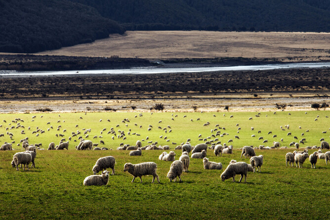
Drones are becoming a powerful ally in sustainable land management across New Zealand - offering smarter, safer, and more targeted ways to care for the whenua. As environmental pressures grow and landowners seek more efficient, low-impact solutions, drone technology is stepping up to meet the challenge.
These airborne tools reduce the need for heavy machinery, lower fuel use, and minimise soil compaction - especially important in erosion-prone hill country and sensitive ecological zones. By enabling precision agriculture, drones allow inputs like fertiliser, herbicide, and seed to be applied only where needed. This targeted approach cuts waste, reduces runoff, and improves productivity while protecting surrounding ecosystems.
Advanced Platforms for Smarter Landcare
TAG Droneworks Limited delivers these benefits using two advanced platforms: the XAG P150 and the DJI Mavic 3 Enterprise.
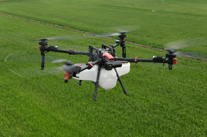
XAG P150: Power and Precision in the Field
The XAG P150 is a high-capacity spraying and spreading drone designed for serious agricultural work. With a 70-litre spray tank and up to 30L/min flow rate, it’s ideal for pasture spraying, selective weed control, re-seeding, and fertiliser application - even on steep or inaccessible terrain. Its dual atomising nozzles produce fine droplets that reduce drift and improve coverage, while its terrain-following radar, automated flow control, and RTK (Real-Time Kinematic) positioning ensure precise, even application across varied landscapes. This level of control is especially valuable when working near waterways, native bush margins, or in complex topography.
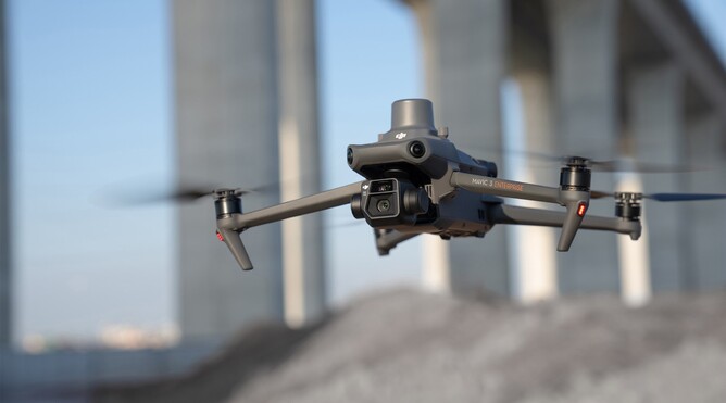
DJI Mavic 3 Enterprise: Mapping for Smarter Decisions
Complementing the P150 is the DJI Mavic 3 Enterprise, a compact yet powerful mapping and monitoring drone. It features RTK positioning, a mechanical shutter, and a zoom camera capable of capturing high-resolution imagery and detailed terrain data. TAG uses this drone to generate orthomosaic maps, assess pasture biomass, identify weed infestations, and plan targeted interventions. These insights allow for smarter decision-making and more efficient resource use - ensuring that treatments are applied only where needed, and in the right quantities.
Tackling Wilding Pines and Other Land Challenges
One standout application is wilding pine control. These invasive trees threaten biodiversity and spread rapidly across high country. TAG Droneworks can map infestations using the Mavic 3E and then deploy the P150 to deliver targeted herbicide from the air - avoiding the need for helicopters or ground crews in remote or rugged areas. This approach reduces cost, improves safety, and protects native vegetation.
Other key services include gorse and thistle control, pasture management, and mapping for reforestation or land restoration projects. By combining high-resolution data with precision application, TAG Droneworks helps landowners manage their properties with greater care, efficiency, and environmental responsibility.
Sustainability and Accountability in Every Flight
Importantly, drone-based operations also support compliance with environmental regulations. Digital flight logs, application records, and geospatial data provide traceability and transparency - valuable for audits, certification schemes, and long-term land stewardship. This data-driven approach ensures that sustainability isn’t just a goal - it’s embedded in every flight.
Together, these systems allow TAG Droneworks to offer efficient, low-impact aerial services that support long-term land health. Whether you're a farmer, forester, or land manager, drone-based solutions are helping New Zealand’s rural sector move toward a more sustainable future - one flight at a time.